SCENIC VIEW CANADA
  • Home
  • Services
  • Media
  • Projects
  • Contact
  • About


Picture


"Better Data Equal's Better Results."

Picture
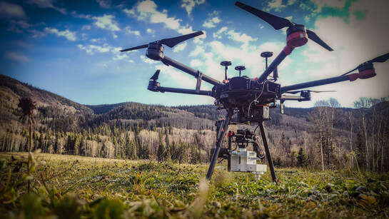
Better data is collected with good field practices, extreme attention to detail and of course better gear. This year we worked hard on all three, Including the following.
  • Simultaneous Lidar and Ortho imagery capture (24Mp camera with 0.8 seconds capture rate)
  • Transport Canada Certified parachute System ( Allows for flights over people)
  • A full moble UAV work box for on the road jobs
  • RTK /PPK Photogrammetry Survey (P4RTK)
  • Terrestrial Lidar mapping
  • 8K Film

Check out our YouTube channel

Our Clients

Picture

Services

  • Lidar Survey PPK
  • Ortho Imagery Survey PPK/RTK
  • Bathymetric Survey PPK
  • Multi-spectral Survey (NDVI)
  • Thermal Survey
  • 100mp camera imagery inspections work
  • Point Cloud data Processing
Click on the Services tab to find out more about what we offer.

Picture
1-778-203-7777
scenicviewcontracting@gmail.com


  • Home
  • Services
  • Media
  • Projects
  • Contact
  • About